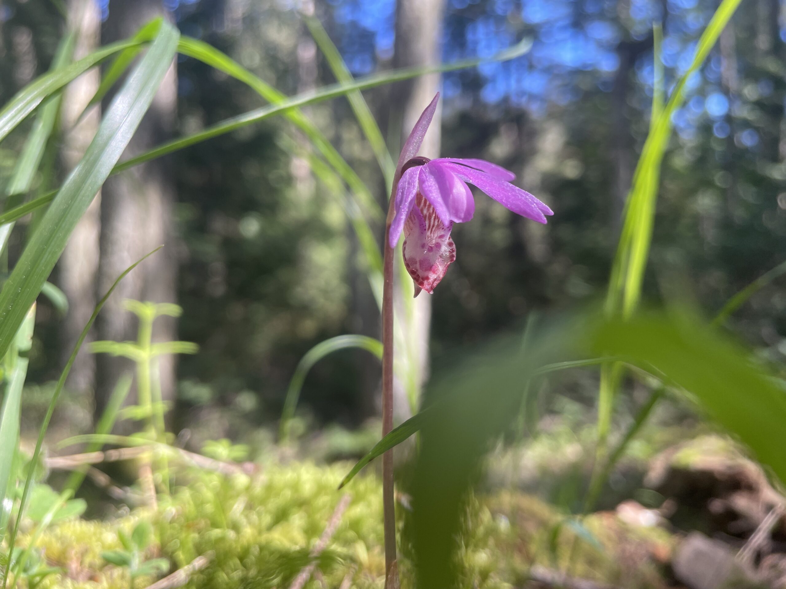
Are there areas on your property that feel special to you—whether a Garry Oak meadow, a wetland buzzing with life, or simply a nice patch of woods? Maybe you’ve noticed pollinators visiting your garden or mature trees providing a home for birds or other species. These ecologically-active spaces are incredibly valuable, and the Nature Stewards Program is provides resources to help you protect and care for them.
Regardless of property size, whether you rent or own, whether you want to preserve biodiverse habitats present on your land, dream of restoring parts of your land to a more natural state, or simply want to support local wildlife, the Nature Stewards Program provides resources to guide and support you and your stewardship goals. Our knowledgeable staff will work with you to create a tailored stewardship plan, and help you care for your property as a haven for nature, and a vital part of the ecosystems supporting our community.
All that’s required to join the program is a voluntary pledge to proactively care for your property’s natural habitats and species. This pledge is not a conservation covenant and is non-binding—it’s simply a personal commitment, based on trust and goodwill, without legal obligations or permanence. It’s an easy way of contributing to conservation at home and on your own terms.
This program provides landowners and land stewards with helpful resources, tools, and support by connecting them with experienced staff to support land stewardship activities.
The program helps overcome barriers to private land stewardship and supports conservation goals, which is especially important as 75% of the Galiano Island is privately owned.
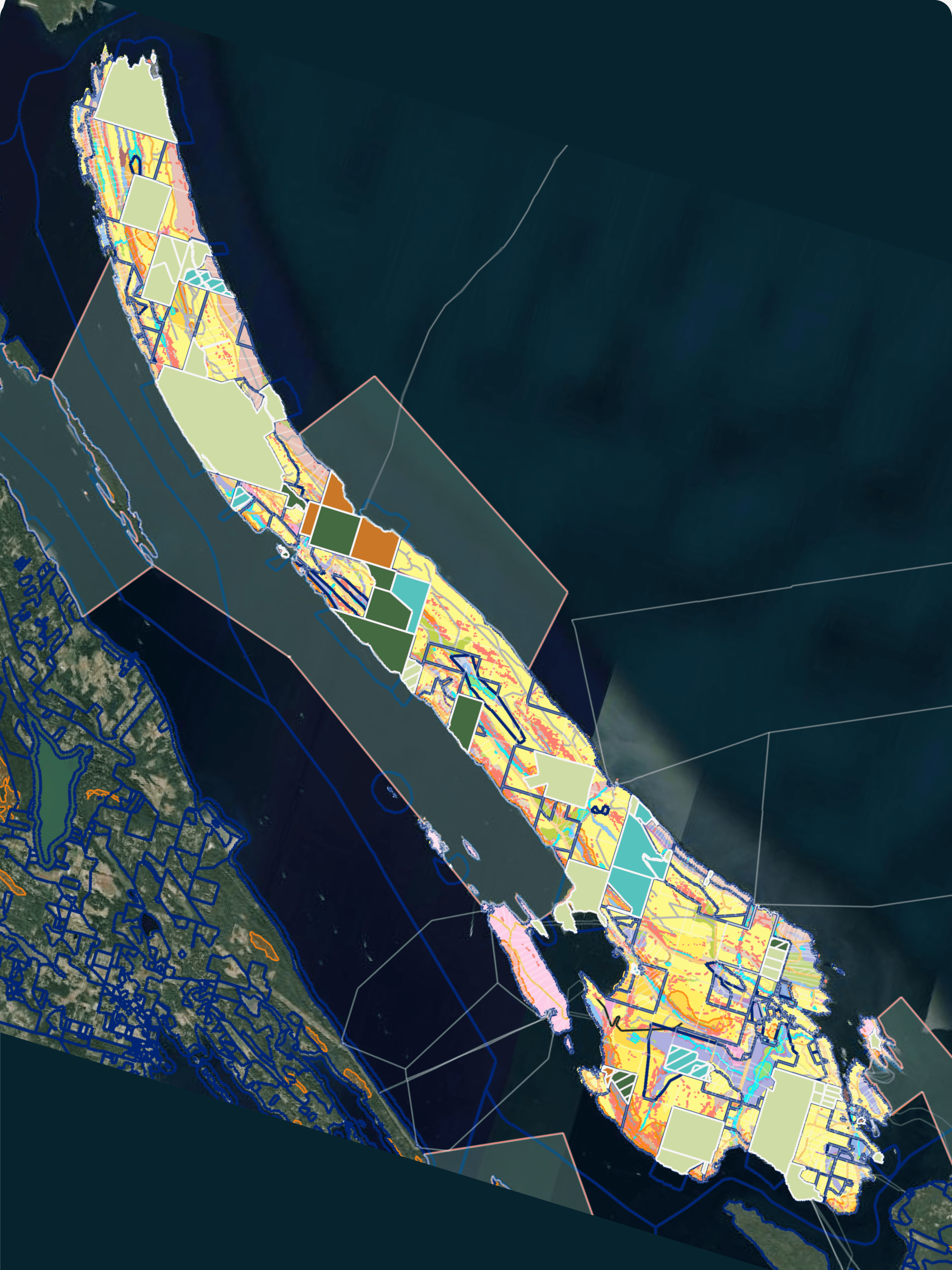
By mapping your property, you will gain property-specific information and understand how your home is connected to the broader Galiano landscape.
Maps can provide information on
… and many other interesting features!
Maps are used to identify how best to manage your property’s unique ecological features.
GCA staff are here to help you interpret these maps and suggest best practices!
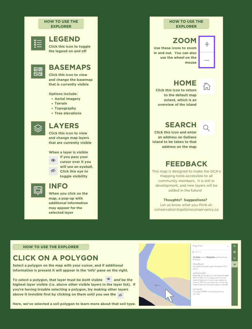
BASEMAPS
LAYERS
Tell us about your property and stewardship goals. This forms helps us understand the ecological context of your property, and how we can help you succeed!
If you have any questions about this program, please don’t hesitate to reach out!
If you can’t find information on a specific stewardship activity please reach out and we can help.
Learn to identify and manage species such as Scotch broom, Himalayan blackberry, and English holly.
Feel comfortable identifying sensitive ecosystems in the Island Trust Area.
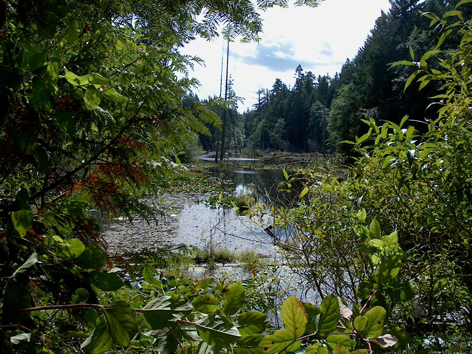
Wetlands are sensitive ecosystems that are at risk! Read up on how to protect these key habitats.
Diverse coastlines surround Galiano. Learn how to protect the interface between terrestrial and marine ecosystems!
Integrate Fire-Smart principles with sustainable land stewardship practices.
Certain native plants have adapted to be fire resistant and can help you fire-smart your property.
Hul’q’umi’num’ language guide to plants and animals of southern Vancouver Island, the Gulf Islands and the Salish Sea.
Join the inaturalist group dedicated to sharing Galiano’s biodiversity.
A conservation covenant will protect your property’s ecological integrity forever.
A digital field guide to celebrate wild food and medicine in the Salish Sea, produced by the Access to Media Education Society.
See the status and location of Species at Risk known or suspected to inhabit Galiano Island.